You Saved 40 Foliage Reels — So Why Haven't You Booked the Trip?
Your camera roll is full of glowing maples — a stash of hidden New England foliage spots you swore you'd visit. Your Notes app has a column of town names you can't quite place. There's a screenshot of a scenic drive you'll never find again.
And there's no trip.
The fantasy is clean: you, a quiet back road, peak color, nobody else in the frame. The reality is the same every October. You open the saves. You feel the pull. You close the app. Repeat until the leaves are gone.
That's not a motivation problem. It's a sequencing problem.
Inspiration is not an itinerary. The gap between the two is exactly where the trip dies.
Why Does Foliage Inspiration Never Become an Actual Trip?
Here's the core problem: you have too much scattered inspiration and zero system to sequence it.
So the real question isn't where to go. You already have 40 answers to that. The real question is: how do you turn saved foliage inspiration into an actual day-by-day route?
Three things are always missing.
Timing. When does each spot actually peak? Northern Vermont and a coastal Massachusetts town are two to three weeks apart. Guess wrong and you drove four hours to look at green.
Geography. What's near what? A pile of pins doesn't tell you two of your saves are 12 minutes apart and a third is a two-hour detour.
A base. Where do you sleep so you're not repacking every morning?
And the person hitting this wall is predictable: an urban professional with limited PTO, decision fatigue from a full work week, who wants the off-peak calm specifically because everything else in their life is loud. Asking that person to manually cross-reference 40 saves against state foliage maps at 11pm on a Tuesday? The trip dies right there.
Why Don't Saved TikToks, Maps Pins, and 30 Browser Tabs Work?
Because none of them carry the data you actually need to plan.
A TikTok save is a vibe with no location, no date, no distance to the next one. You watched it. The algorithm moved on. The information you need — where is this and when does it look like that — was never attached.
Google Maps pins are better, barely. They pile up into a constellation of dots. But a dot doesn't tell you its peak week, and it doesn't tell you a logical order to drive them.
Tabs and screenshots rot. You re-research the same town three times because each session you forget you already looked. That's not planning. That's a loop.
Then there's the crowd problem, which is the cruelest part: the spots that went viral are the exact spots now mobbed by 11am. The reel sold you solitude. The reality is a parking line in Stowe.
So the honest version of the question is: how do I plan a New England foliage road trip from a bunch of saved TikToks — without re-doing the same research five times and still ending up in a crowd?
How Has Leaf-Peeping Changed in the TikTok and AI Era?
Discovery flipped. We now find spots faster than we could ever organize them.
That's the whole shift in one sentence. Ten years ago the hard part was finding the hidden valley. Now the hard part is that you've found 40 of them and they're trapped in four different apps.
Virality also kills the thing it's selling. The moment a "hidden" spot trends, it isn't hidden. Saturation means the crowd-free move is almost never the famous landmark — it's the town one valley over from the famous landmark. Same color. Same light. A tenth of the people.
So the new bottleneck isn't inspiration. It's sequencing. Discovery got automated. Planning didn't.
Which reframes the classic argument — Vermont or New Hampshire for fewer crowds? Wrong axis. Off-peak doesn't mean less good. It means lesser-known. The state isn't the variable. The specific pocket is.
How Can AI Turn a Pile of Saved Spots Into a Real Route?
It does the logistics your brain hates: clustering 40 locations by geography, cross-referencing each against a peak-color window, and ordering stops so you never cross your own path twice.
That's not inspiration work — it's logistics, and logistics is exactly where AI earns its keep.
Here's what it actually does with your mess:
Step 1. Dedupe the saves — three reels of the same overlook collapse into one stop.
Step 2. Geolocate each one, even the ones with no caption, so a vibe becomes a coordinate.
Step 3. Group nearby stops into clusters you can drive in a single day.
Step 4. Flag timing conflicts — this northern stop peaks before this southern one, so the order matters.
Step 5. Propose a drive sequence that minimizes backtracking.
Now set expectations honestly, because this is where people overpack the trip. A 2-day weekend is a realistic 3–4 stops. Seven is a long-weekend number — three to four days, tight loop, central base.
The payoff is the thing you actually wanted from the start: a shortlist of 7 lesser-known, crowd-free spots, a per-state peak calendar, and a drive order that turns them into one trip instead of 40 tabs.
Where Does Roamee Fit In?
This is the gap we've been thinking about at Roamee. Lomit Patel has made the case that the real job of AI travel planning isn't discovery anymore — it's the logistics — and that's exactly the unglamorous middle part Roamee handles. You feed it the saved reels and links you already have, and it geolocates them, clusters what's near what, checks peak windows by state, and hands back a sequenced, day-by-day route. Not a wall of suggestions. A route. It's meant to be the bridge between "saved 40 reels" and "booked, ordered itinerary," so the planning step stops being the reason the trip never happens.
What Does Planning a Trip to Hidden New England Foliage Spots Actually Look Like?
Here it is concretely: 40 scattered saves go in, and a sequenced 3-day route through hidden New England foliage spots comes out.
You save: 40 reels across a month of scrolling, a handful of town names typed into Notes, and two screenshots of scenic drives with no labels.
The system does the sorting:
- It geolocates each save, including the unlabeled drive screenshots.
- It spots that three of your saves are the same viral overlook and three more are spots that trend hard and clog by late morning. Those get flagged as crowd risks.
- It clusters the survivors into two driveable groups.
- It checks peak windows — your northern stops want early October, your southern stops want mid-to-late October — and orders them so you chase the color in the right direction.
What you get back:
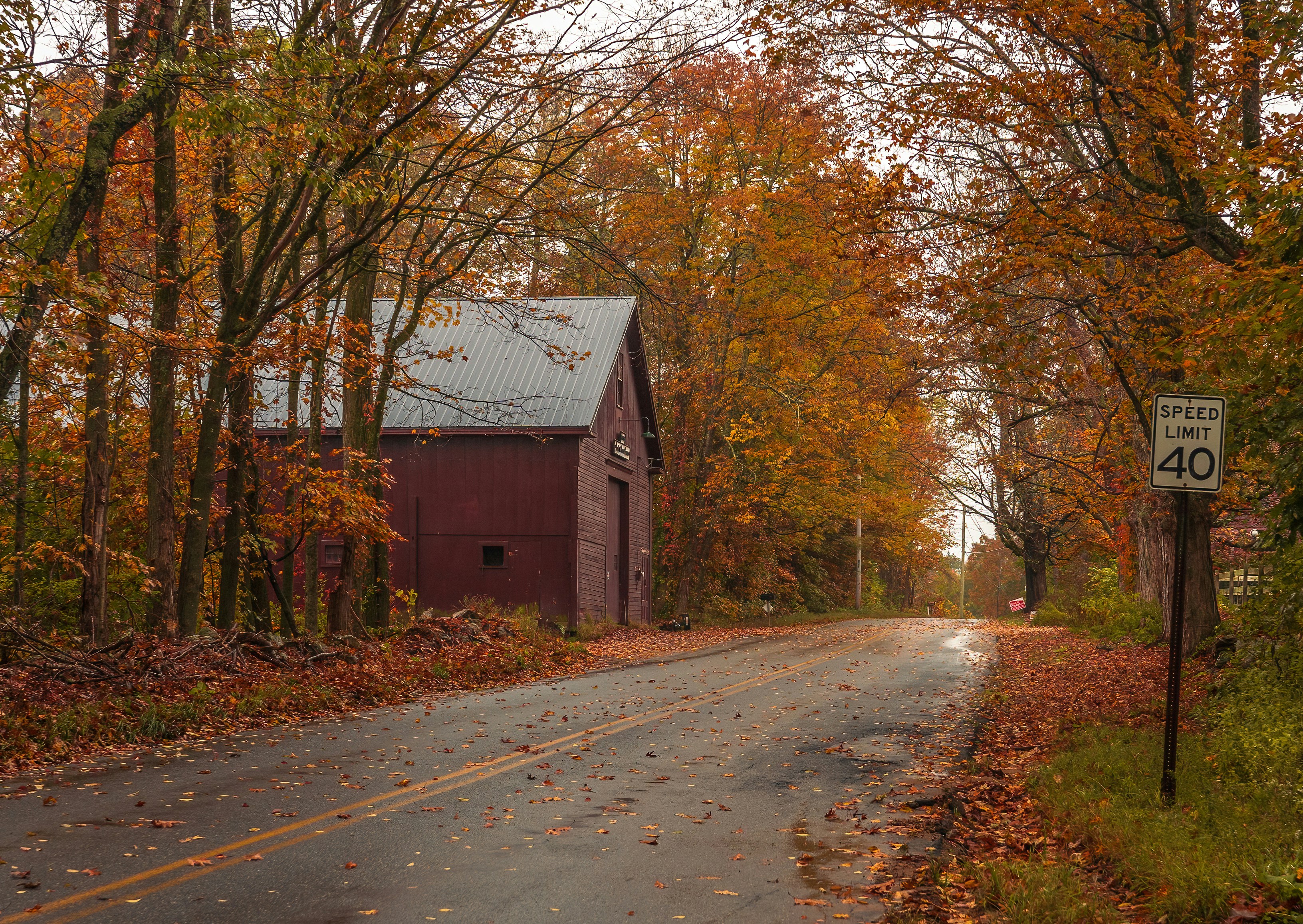
The 7 spots. Lesser-known towns, working-farm valleys, and gravel byways instead of the landmark everyone screenshots. Think one valley over from the headline name — state forests and back roads, not the resort parking lot.
The peak calendar. Northern VT/NH/ME run late September into early October. Central VT/NH/MA land mid-October. Southern CT/RI and coastal MA hit mid-to-late October. Elevation and that year's weather slide the windows, so it's a window, not a date.
The drive order. A 3-day loop with minimal backtracking, each day a single cluster.
The base. One central gateway town near your tightest cluster — smaller and quieter than the famous hub, so you day-trip out and back instead of repacking.
The prep list. Layers, waterproof shoes, offline maps for dead rural signal, cash for farm stands, a full tank, and a flexible day in case peak shifts.
That's the whole move. Same 40 saves. Now they're a trip.
What's the Future of Planning Seasonal Trips Like This?
Planning collapses toward zero.
Live foliage trackers, crowd levels, and weather feed straight into the route instead of sitting in separate tabs you check manually. The itinerary stops being a static document and starts being a thing that reacts.
Peak comes a week early this year? The route re-orders itself before you've noticed. A storm strips a ridge? It swaps in the cluster that's still holding color.
The deeper shift is that inspiration and itinerary stop being two disconnected piles. You save a reel, and it lands in a plan that already knows where it is and when it peaks. One continuous loop, not a research project you start from scratch every October.
That's where seasonal travel planning is heading broadly — discovery and logistics finally living in the same place.
The Real Reason Your Foliage Trip Keeps Slipping
The trip never dies from a lack of inspiration. You have more inspiration than you can use.
It dies from a lack of sequence.
And the crowd-free version isn't luck. It's a planning advantage anyone can take: go lesser-known instead of viral, go off-peak instead of headline week, go ordered instead of improvised.
The leaves don't wait. Turn the saves into a route this week — before peak slips past you again.
New England Foliage Trip Planning: Quick Answers
Where can I see New England fall foliage without the crowds?
Skip the viral hubs — Stowe, the Kancamagus at midday — and go one town or valley over. The lesser-known pockets get the same color with a fraction of the people. Rule of thumb: smaller state forests, working-farm valleys, and gravel scenic byways beat the Instagram landmarks almost every time. The crowd follows the famous name, not the best color.
When does fall foliage peak in each New England state?
It moves roughly north to south. Northern Vermont, New Hampshire, and Maine peak late September into early October. Central VT/NH/MA land around mid-October. Southern Connecticut, Rhode Island, and coastal Massachusetts hit mid-to-late October. Elevation pulls higher spots earlier, and a given year's weather can shift any window by a week or more.
How do I turn my saved foliage reels into an actual itinerary?
Four steps. First, dump every save into one place. Second, geolocate each spot so a vibe becomes a coordinate. Third, cluster the nearby ones and drop the crowded duplicates. Fourth, order them by drive efficiency and peak timing. Steps two through four are exactly what an AI planner like Roamee automates so you're not doing it by hand at midnight.
Can I really see 7 foliage spots in one weekend?
Not in a two-day weekend — that's a realistic 3–4 stops. Seven is a long-weekend target, three to four days with a tight loop. The trick is clustering stops that are near each other and picking one central base, so you cut the backtracking that eats your daylight.
Should I go to Vermont or New Hampshire for less crowded leaf peeping?
Both work. Crowd level is about which spots you pick, not which state. Vermont leans pastoral valleys and dirt-road byways; New Hampshire has dramatic ridgelines, though its famous drive packs out fast. Choose by the lesser-known pockets in either state, not the headline name on the map.
How do I check foliage timing so I don't miss peak?
Use state foliage trackers and recent local reports — not last year's dates, which lie. Watch elevation, since higher means earlier, and factor in recent weather. Build a 3–5 day buffer into your trip and let the route flex if peak shifts, instead of locking one exact day.
Where should I stay to base a crowd-free foliage trip?
Pick one central base near your tightest cluster of stops. Choose a smaller gateway town over the famous resort hub — it's cheaper, quieter, and usually has rooms left. Then day-trip out and back each day to minimize repacking and pointless driving.
What should I pack and prep for an off-peak fall getaway?
Layers and waterproof shoes, plus real warmth for early mornings — peak light means cold dawns. Download offline maps and your route, because rural signal is spotty. Carry cash for farm stands, keep a full tank, and leave one day flexible in case peak comes early or runs late.